

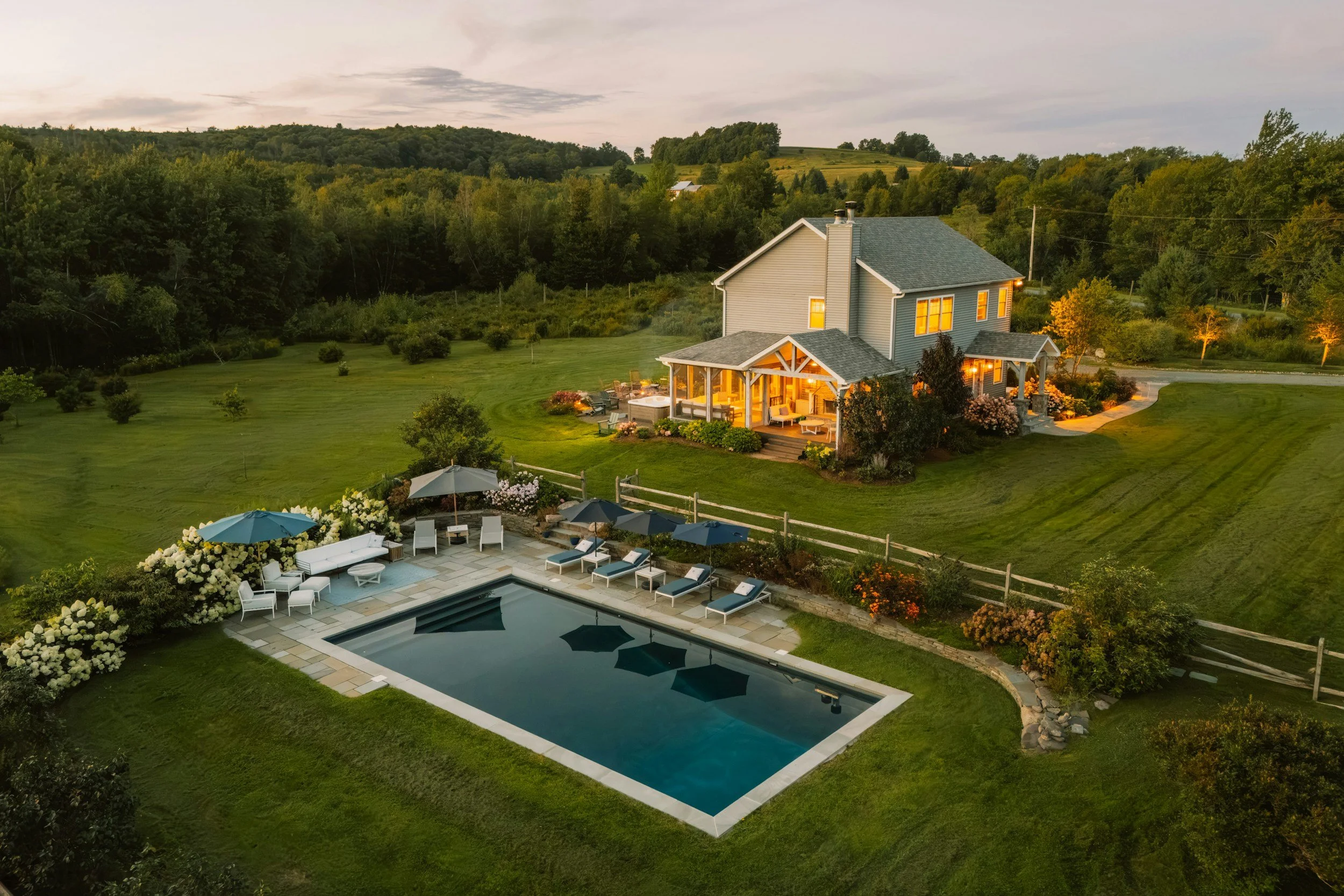
Inside and Out. One Visit.
Real estate photography, drone video and 3D virtual tours for listings and hunt-country estates in Loudoun, Fauquier and Northern Virginia.
FAA Part 107 Certified · Fully Insured · Marine Corps Veteran-Owned
Interiors, aerials and a 3D tour in one appointment
Most listing photographers stop at the front door, and most aerial pilots never step inside. Root & Sky AI does both in a single appointment, so the listing goes live with bright, true-to-life interiors, the land and setting from above, and a 3D tour buyers can walk on their own time.
We photograph listings and estates across Loudoun and Fauquier counties, from Middleburg, Upperville and Leesburg to Purcellville, Ashburn and Warrenton. Mike lives in Middleburg, so hunt-country estates and horse properties are close to home. On those listings the land matters as much as the house, and we shoot both on the same visit.

Listings with 3D tours can sell up to 31% faster and for up to 9% more.1
What we do
Real estate photography and drone services
Interior photography
Every key room, carefully lit and edited, straight and true to life, ready for the MLS.
Real estate drone photography
The home, the acreage, the approach and what sits nearby, captured from above by an FAA Part 107 certified drone pilot.
Listing video
A 60 to 90 second film that blends aerials with a smooth walkthrough of the house, for social posts, YouTube and the MLS video link.
3D virtual tours (SceneScape360)
An immersive walkthrough, like the Matterport tours buyers know, that they can explore from anywhere, on any device. Out-of-town buyers can walk the house before they book a showing.
Twilight photos
The house and grounds at dusk with every light on, from the ground and from the air. Often the strongest cover photo for a luxury listing.
Property-line overlays
Aerial photos with the approximate lot lines and acreage drawn on, so buyers see exactly what comes with the house.
Land and farm maps
A measured overhead map of the acreage, pastures, fences and outbuildings, for land listings, farms and estates.
Agent intro videos
A short on-camera clip of you at the property or around town, for your website and social.
What you get
Ready for the MLS, social and print
Illustrations of each deliverable. Photos, video and your tour link arrive in MLS, social and print sizes.
Packages
Listing packages
Pricing depends on the house, the acreage and the package. Send the address and listing date and Mike will quote it.
Aerial
Exterior and aerial stills plus a short aerial video. Ideal for land, farms and estates.
Claim your free shoot →Listing Complete
Interior photography plus aerial stills and video, all in one visit.
Request a quote →SceneScape360
Everything in Listing Complete, plus an immersive 3D tour.
Request a quote →Estate & Land
Everything in SceneScape360, plus twilight photos, property-line overlays, a measured land map and a longer estate film. Built for hunt-country estates, farms and acreage.
Request a quote →Your first Aerial package is on us.
One per agent, on an active listing, so you can see the quality before you commit.
Who we work with
Agents, estate owners and builders
Listing agents
Reliable, MLS-ready photos, aerials and tours for every listing, booked in minutes.
Hunt-country estate and luxury agents
Estates, horse properties and acreage around Middleburg, Upperville, The Plains and Purcellville, where buyers are paying for the acreage as much as the house.
Land and farm agents
Aerials, property-line overlays and measured maps that show buyers the whole property before they drive out. For working farms, see our farm mapping services.
Estate owners
Owners preparing to sell, or who want a lasting record of the property, can book us directly.
Builders
Listing photos for new homes. See our construction drone services.
Getting the home ready
A little prep makes a big difference on camera. Before we arrive:
Lights onEvery lamp and overhead light, with blinds and curtains open.
Clear surfacesCounters, tables and the fridge door, including soap, sponges and small appliances.
Personal items awayFamily photos, mail, pet bowls and toys.
BathroomsToilet lids down and fresh towels hung neatly.
OutsideCars out of the driveway, trash cans and hoses put away, lawn mowed.
Pools and fountainsCovers off and water features running.
How it works
From booking to launch
- 01
Book
Tell us the address, the listing date and what you need. We confirm a time that works for you and the seller.
- 02
Prep
We send our "Getting the home ready" checklist, check the airspace and plan around the best light for the house.
- 03
One visit
Mike captures interiors, aerials and the 3D tour in a single appointment, so the home is only disrupted once.
- 04
Launch
You receive edited photos, video and your tour link in MLS, social and print sizes, ready to drop into the MLS and your marketing.
Good questions
What agents ask us
Tell us about your listing below and we'll get your free aerial shoot on the calendar.
Do you really shoot interiors too?
Yes. Interiors, aerials and 3D tours are all done by the same team on the same visit, so the home is only disrupted once.
Are you licensed and insured?
Mike is an FAA Part 107 certified drone pilot and Root & Sky AI is fully insured.
Where do you work?
Northern Virginia, Washington DC and the Shenandoah Valley, and most often around Middleburg, Upperville and Leesburg, close to where Mike lives.
What does it cost?
It depends on the property and the package. Tell us the address and what you need, and we will send you a quote.
How soon can you shoot?
Tell us your listing date and we'll schedule around it. More notice is always welcome.
Can I get high-resolution files for print?
Yes, at no extra charge. Just tell us when you book.
Are the photos MLS-ready?
Yes. Photos are delivered sized for the MLS, so you can upload them as they are.
What does the free shoot include?
Your first Aerial package is on us: one per agent, on an active listing, so you can see the quality before you commit. Tell us about the listing below and we'll get it on the calendar.
Do you show property lines?
Yes, on aerial photos, always labeled approximate. For a certified boundary, the seller needs a licensed surveyor.
Do you edit or virtually stage photos?
We correct lighting and color. We never remove permanent features or change views, and any virtual staging is clearly labeled.
Can you shoot at sunset?
Yes. Twilight photos are timed for just after sunset, with every light on.
Do you work with estate owners directly?
Yes. Estate owners can book us directly, before choosing an agent or to keep a record of the property.
Get in Touch
Tell us what you're working on. Mike reads every message and calls back himself.
Call (888) 821-7668
Email mike@rootandskyai.com
Serving Northern Virginia, Washington DC and the Shenandoah Valley