

Every Site. Every Stage. One Clear View.
Construction drone services, progress photography, site mapping and roof inspections for builders and developers in Loudoun, Fairfax, Prince William and Northern Virginia.
FAA Part 107 Certified · Fully Insured · Marine Corps Veteran-Owned
Keep every stakeholder looking at the same picture.
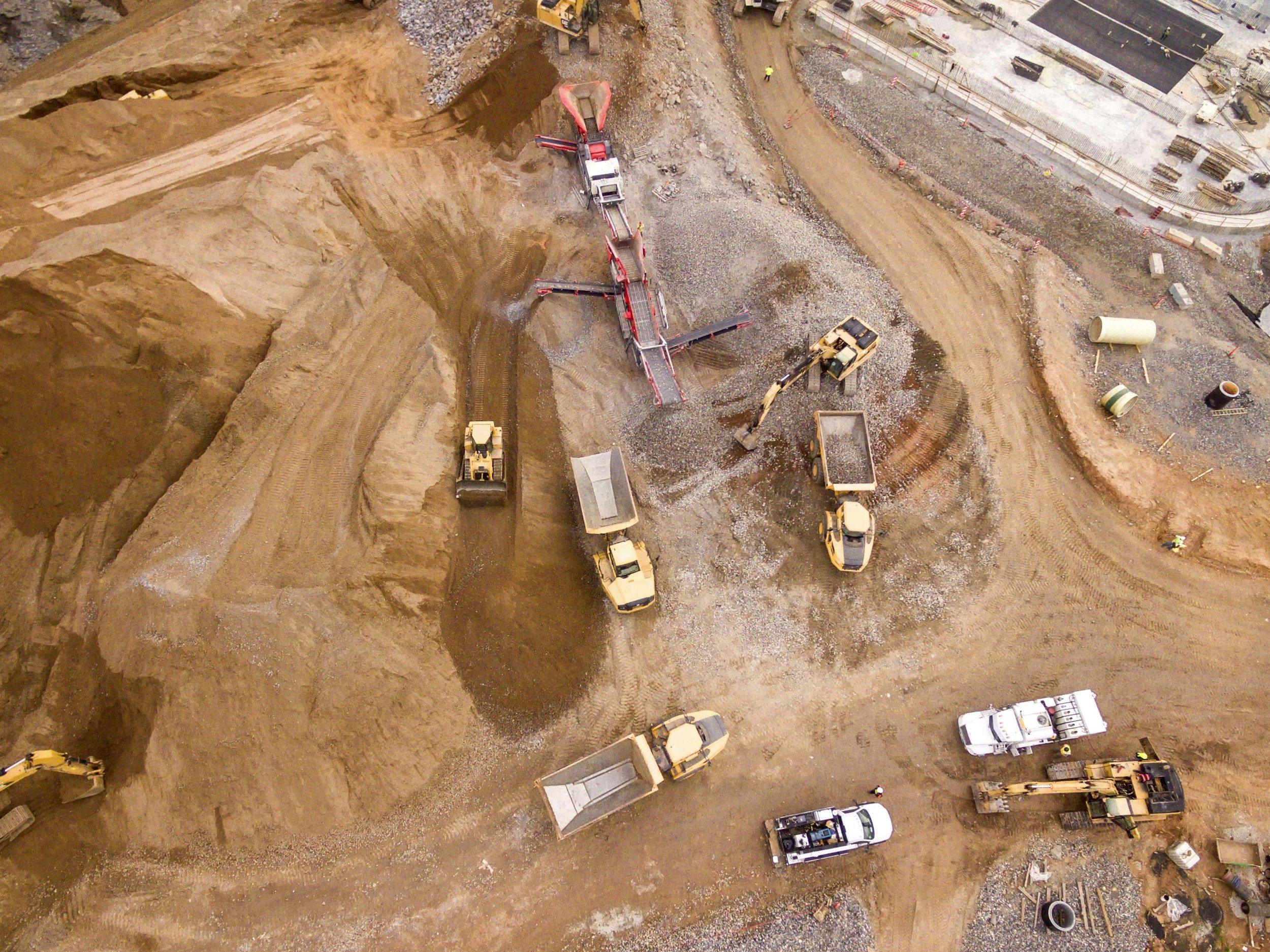
Owners want to see progress, lenders want dated records, and your superintendent wants to catch problems before they become change orders. Regular drone capture gives everyone the same up-to-date view of the site, without another walk or another ladder.
We cover job sites, new communities and commercial roofs across Loudoun, Fauquier, Fairfax and Prince William counties, from Leesburg and Ashburn to Warrenton and Middleburg.
Mike spent years at VMware, the company whose software runs modern data centers. We cover the data center corridors of Ashburn, Leesburg and Prince William County with scheduled progress capture and site mapping.

Nearly half of construction rework traces back to poor data.4
What we do
Construction drone services
Construction progress photography
The same aerial angles shot on every visit from saved flight paths, plus a short video, so each week or month lines up with the last and changes jump out. A dated record for owners, lenders and your own team.
Site maps (orthomosaics)
One sharp, measurable overhead map of the whole site, stitched from hundreds of photos. Measure distances and areas, compare progress against the site plan, and share it with a link. For stamped topographic surveys, we fly for your licensed surveyor.
Stockpile and cut-and-fill volumes
An elevation model of the site compared with the last visit, showing roughly how much material moved or sits in each pile. Built for internal tracking and pay applications.
3D site models
A 3D model of the site or building, built from angled photos, that owners and investors can spin and measure.
Drone roof and facade inspections
Close-up zoom photos of every roof section and wall, with no ladders, lifts or anyone on the roof, and a marked-up report of what we found.
Aerial 360 panoramas
A spherical view from above the site that viewers can pan around on a phone, ideal for investor updates and project websites.
Finished-project marketing
Polished aerial and ground photos and video of the completed building or home, for your portfolio, leasing and sales.
Thermal roof scans
Heat-camera roof and envelope inspections that find trapped moisture, insulation gaps and failed solar panels. Tell us below if you'd like to be first on the list.
What you get
One shared project folder
Illustrations of each deliverable. Dated photos, video and site maps, ready to forward to owners and lenders.
Packages
Construction drone packages
Cost depends on the size of the site and how often we fly. Send the address, the schedule and who needs the updates.
Site Snapshot
One visit: aerial photos from set angles and a short video.
Request a quote →Progress Program
Weekly, every-two-weeks or monthly visits with same-angle photos, video and a site map each time, all in one shared project folder.
Request a quote →Earthwork Tracker
A site map with stockpile or cut-and-fill volumes compared with the last visit.
Request a quote →Roof & Facade Inspection
Zoom photos of every roof section and wall, with a marked-up report.
Request a quote →Project Closeout
A final site map, 3D model, aerial 360 and marketing photos and video of the finished project.
Request a quote →A dated record of the whole build, from the first grading pass to closeout.
Who we work with
Builders, contractors, managers and lenders
Custom home builders
Progress updates for owners who live elsewhere, and marketing images when the home is done. Listing it? See our real estate services.
General contractors and developers
Regular, consistent records for owners, lenders and the home office, from groundbreaking to closeout.
Site work and earthwork contractors
Site maps and volumes to track grading and back up pay applications.
Property managers and HOAs
Roof, facade, parking lot and pond checks across your buildings and communities.
Owners' reps and lenders
Dated documentation that matches your draw schedule.
Land developers
Site maps and aerials of raw land for investors and the county. For farms and large acreage, see our land mapping services.
Capture for every phase
Weekly, biweekly or monthly capture keeps the record consistent from groundbreaking to closeout.
How it works
Same angles, every visit
- 01
Scope it
Tell us the site, the schedule and who needs to see what. We check the airspace and your site safety requirements, and put together a capture plan.
- 02
Set the angles
On the first visit we do your site orientation, meet your superintendent and save the exact flight paths, so every visit after matches the last.
- 03
Capture on schedule
Weekly, every two weeks or monthly, with the same pilot each time, timed around your crews and cranes.
- 04
Share in one click
Dated photos, video and site maps land in your project folder, ready to forward to owners and lenders.
- 05
Close it out
Finish with a final site map, 3D model and marketing photos and video, plus a before-to-after sequence of the whole build.
Good questions
What builders ask us
Tell us about your project below and we'll put together a capture plan.
How much does construction drone photography cost?
It depends on the site, how often we fly and what you need. Tell us about your project below and we'll send a clear quote.
Can you fly near airports or Washington DC?
Much of the region sits in controlled airspace. We check every site in advance, request FAA authorization where it's available, and tell you up front if a location can't be flown.
Can you set up a recurring schedule?
Yes. Weekly, biweekly or monthly capture keeps the record consistent from groundbreaking to closeout.
Do you fly over workers?
We plan flight paths around active crews and coordinate timing with your superintendent, following FAA rules for flights over people.
Can you measure stockpiles and earthwork?
Yes, for tracking and pay applications. For stamped topographic surveys, we fly for your licensed surveyor.
What about data center and secure sites?
We work under NDAs, approved flight zones and photo review, and nothing is used in our marketing without written permission.
Do you do thermal roof scans?
Coming soon. Our roof inspections today are high-resolution visual inspections with a zoom camera.
Are you licensed and insured?
Yes. Mike is an FAA Part 107 certified drone pilot, and Root & Sky AI is fully insured.
Get in Touch
Tell us what you're working on. Mike reads every message and calls back himself.
Call (888) 821-7668
Email mike@rootandskyai.com
Serving Northern Virginia, Washington DC and the Shenandoah Valley